
Shipwreck Graveyard Discovered At the Bottom of the Black Sea
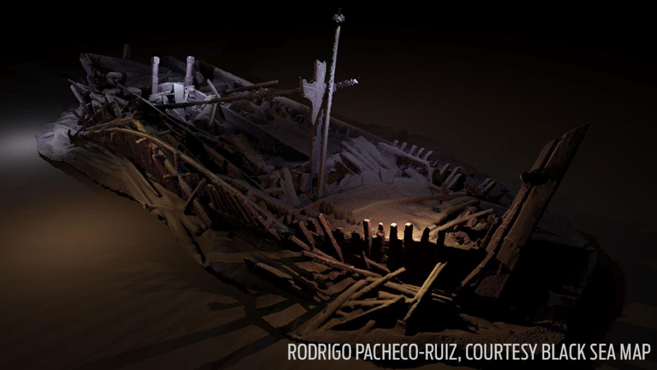
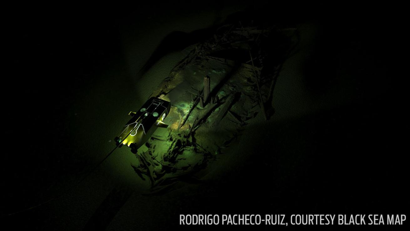
Rodrigo Pacheco-Ruiz, Courtesy Black Sea MAPA shipwreck from the Ottoman period discovered in 300m (984 ft) of water. Many of its timbers are carved. This image is a photogrammetric model created from photographs taken by cameras on the ROV, rendered with light sources.
Researchers discovered a shipwreck graveyard at the bottom of the Black sea with more than 40 well-preserved wrecks.
The ghostly fleet was discovered on accident while scientists from the Black Sea Maritime Project were conducting geophysical surveys of the ancient ice age era landscapes submerged beneath the surface. The team was looking for clues in the former land surfaces to gain a better understanding of the prehistoric rise in water levels’ effect on the surrounding area and the humans who lived there about 12,000 years ago.
The team found 41 different ships scattered throughout the region up to depths of 7,000 feet below the surface of the Black Sea. The vessels in this underwater graveyard cover a thousand years of human history, from the 9th century to the 19th century.
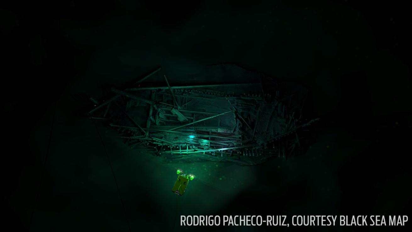
Rodrigo Pacheco-Ruiz, Courtesy Black Sea MAPPhotogrammetric model of the Ottoman wreck discovered in 300m (984 ft) of water. It is overlaid with an image of the ‘Work Class’ Supporter ROV to illustrate the manner of its recording.
Underwater archaeologists are able to loosely date the ships and where they sailed by analyzing the styles of clay pots in the cargo, the type of anchors they have and by the arrangement of their masts and rigging.
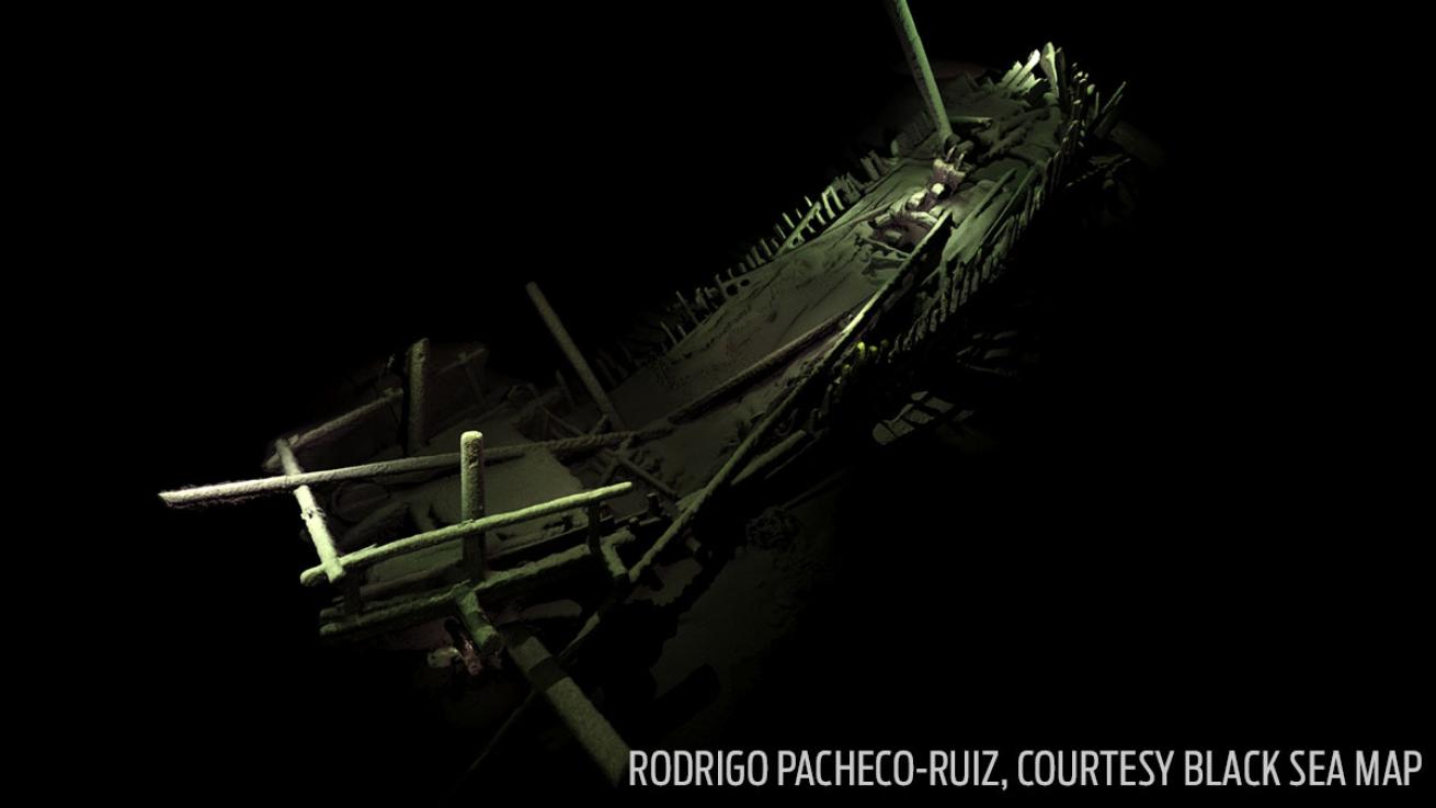
Rodrigo Pacheco-Ruiz, Courtesy Black Sea MAPA shipwreck from the Medieval period of a type we know from history and a few fragmentary archaeological finds but never before seen so complete - photogrammetric model constructed from 4,500 high resolution photographs taken by cameras on the ROV.
Many of the ships were merchant vessels stretching from the Byzantine Empire to the Ottoman Empire. Other notable wrecks include what Jon Adams, a professor of Archaeology at the University of Southhampton and the principle investigator on the project, calls “oar-powered Cossack raiding vessels” and a medieval Italian merchant ship, which could have very well been recognized by Marco Polo.
Wrecks from the Byzantine and Ottoman Empires will provide new information on the local communities that lived in the region and the commercial and colonial activities of ancient Greece and Rome in the Black Sea.
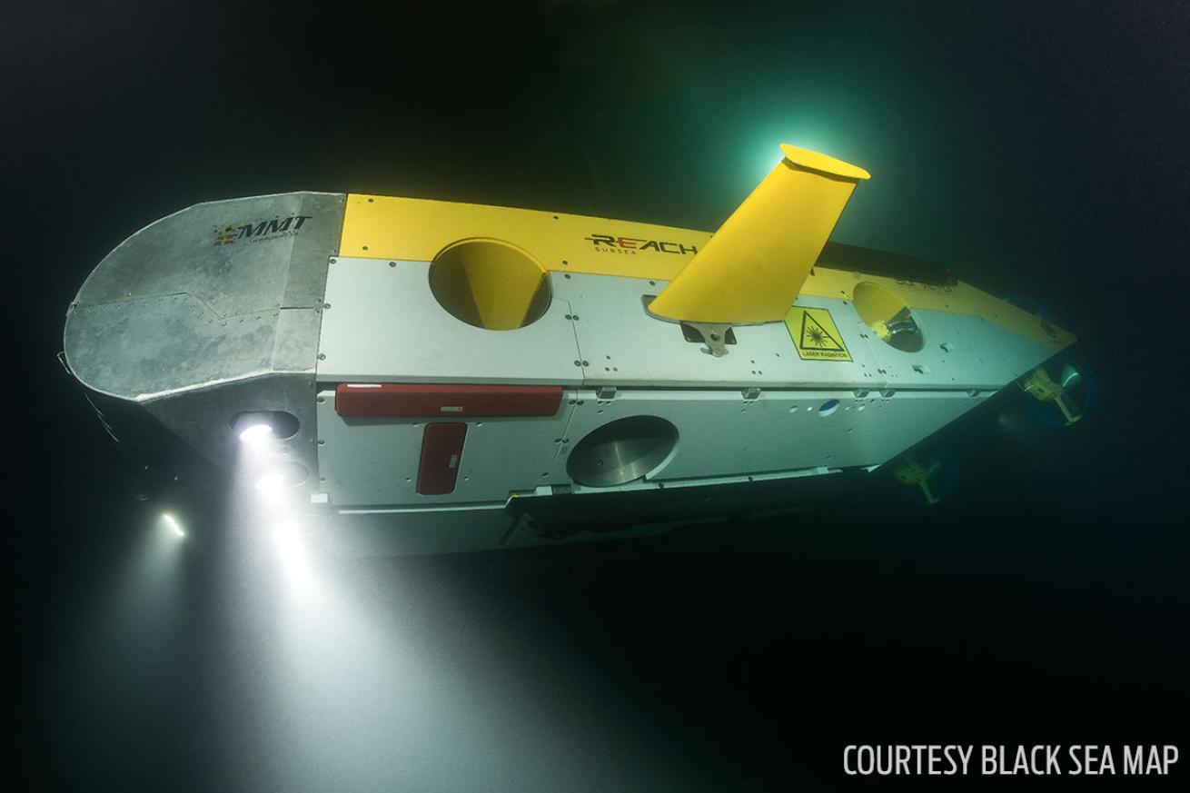
Courtesy Black Sea MAPThe Remotely Operated Vehicle (ROV) Surveyor Interceptor. It flies at 4-6 knots, 3-4 times as fast as conventional ROVS. It carries multi-beam and side scan sonar, sub-bottom profiler, HD cameras, powerful lights and a laser scanner.
Rodrigo Pacheco-Ruiz, Courtesy Black Sea MAPA photogrammetric model of a Byzantine wreck discovered in 95m (355 ft) of water illustrating the Surveyor ROV passing over it gathering 3D data. Constructed from photographs taken by cameras on the ROV.
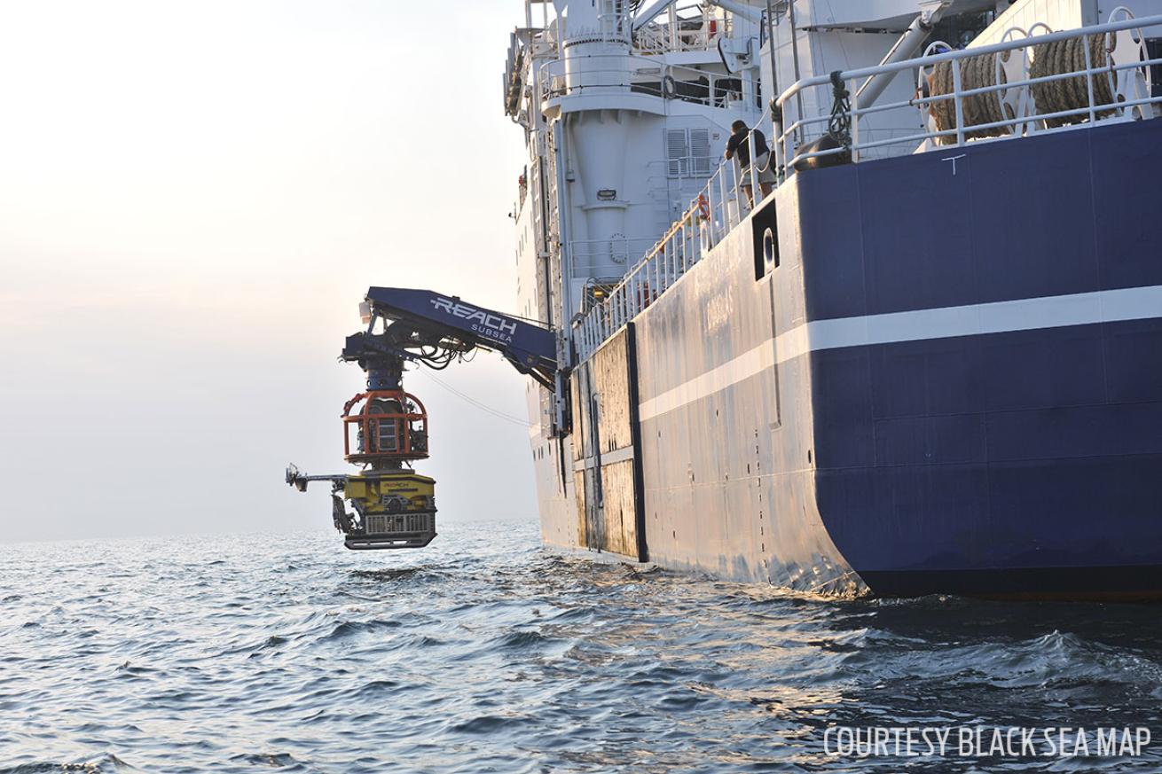
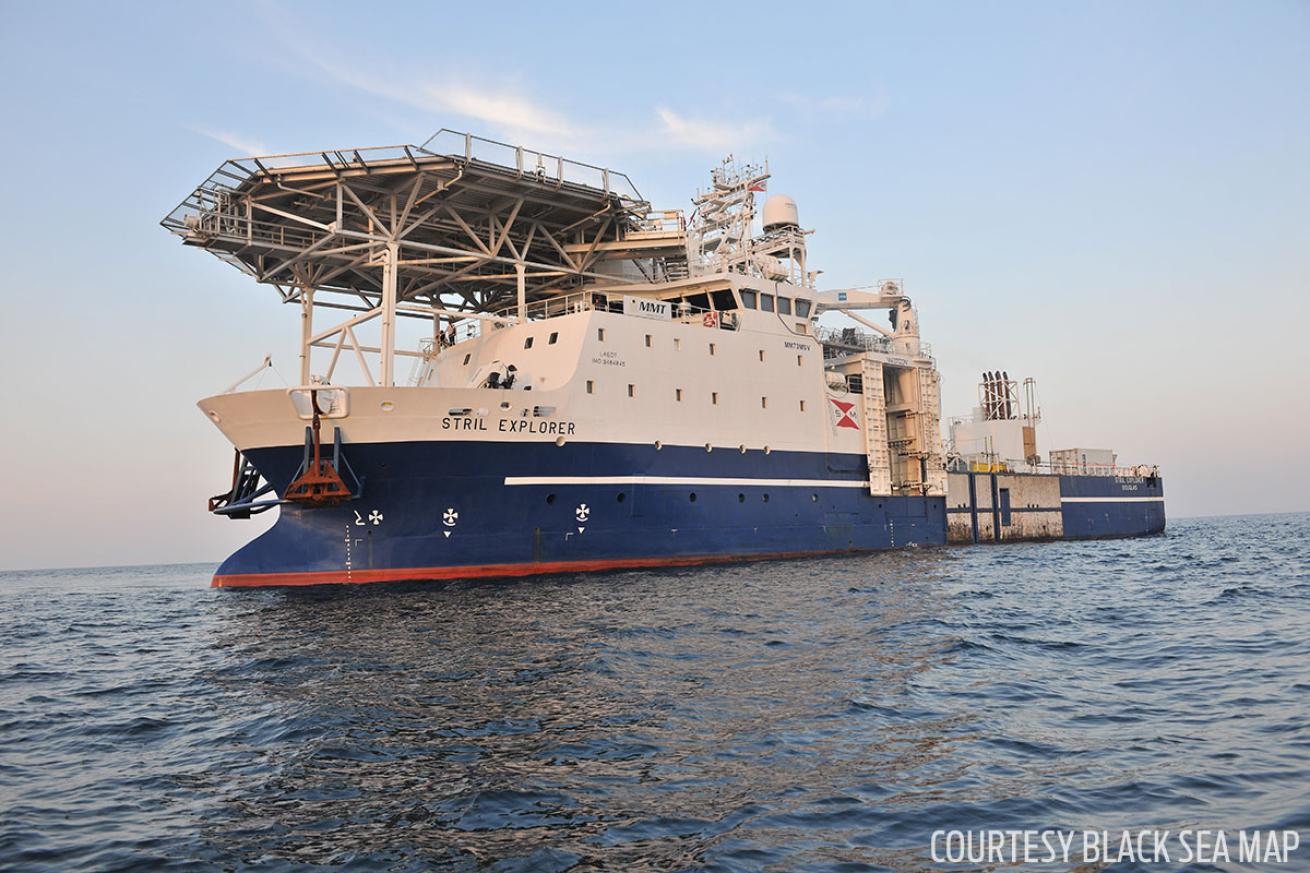
Courtesy Black Sea MAPStril Explorer - the project's research vessel for 2016, launching the Work Class Supporter ROV.
Not only is the amount of wrecks incredible, but these underwater time capsules are also exceptionally well preserved. That’s thanks to the unique anoxic (witout-oxygen) environment of the Black Sea. In ancient times warming temperatures caused sea levels to rise and the Mediterranean Sea to spill over the Bosphorus Strait into what was then a freshwater lake. The Black Sea, now a body of water fed by both freshwater and saltwater, has two distinct layers of water. An upper layer with low salt content and high oxygen levels and a bottom salt layer that lacks oxygen.
“The oxygen drops to zero below 150 meters (490 feet), which is ideal for the preservation of organic material,” Adams said.
Things like rigging materials, coils of rope, tills, rudders and carved decorative elements (such as intricate figureheads) have survived being submerged for centuries. Some of the ships are so well preserved that marks left by chisels and other construction tools are still visible on the wooden planks.
“Nobody has seen anything quite like this before,” Adams said.
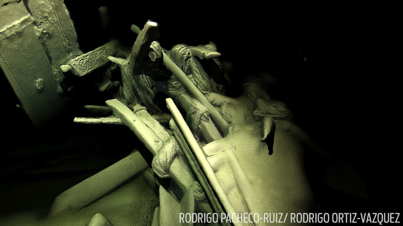
Rodrigo Pacheco-Ruiz/ Rodrigo Ortiz-VazquezDetail of the stern of the Ottoman shipwreck discovered in 300m (984 ft) of water. The carved tiller lies by the stern post and rudder. The astonishing preservation of organic materials is shown by the coils of rope still hanging from the timbers. Photogrammetric model rendered and light-sourced.
“Using the latest 3D recording technique for underwater structures, we’ve been able to capture some astonishing images without disturbing the sea bed,” Adams said. “No-one has achieved models of this completeness on shipwrecks at these depths.”
Courtesy Black Sea MAPStril Explorer - the project's research vessel for 2016, launching the Surveyor Interceptor ROV.
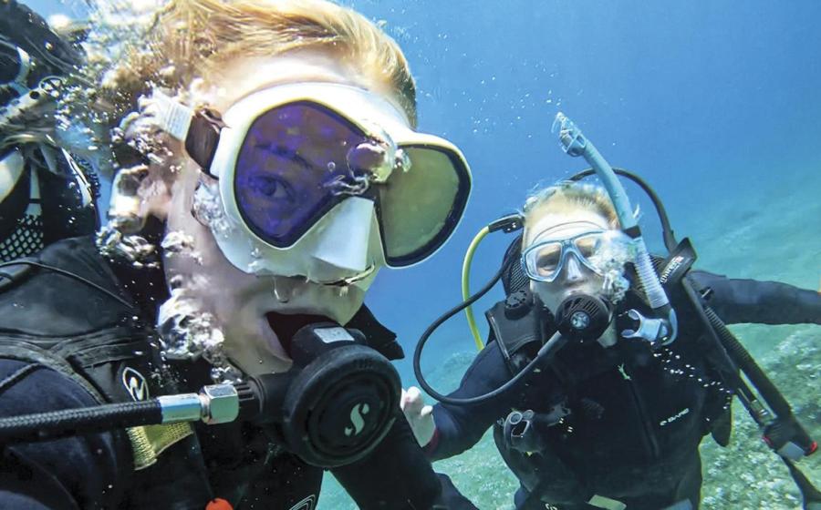
The team of British, American and Bulgarian researchers spent nearly a month aboard the Stril Explorer using advanced sonar detection and two underwater remote operated vehicles , each about the size of a minivan with a receipt of $7 million to $8 million.
The first ROV, called Work Class Supporter, is designed for high-resolution 3D photogrammetry. This process allows scientists to create accurate, finely detailed models of objects using thousands of photographs. This technique allows scientists to measure and examine objects that are otherwise difficult to access (read: deep underwater) and leave them in-situ.
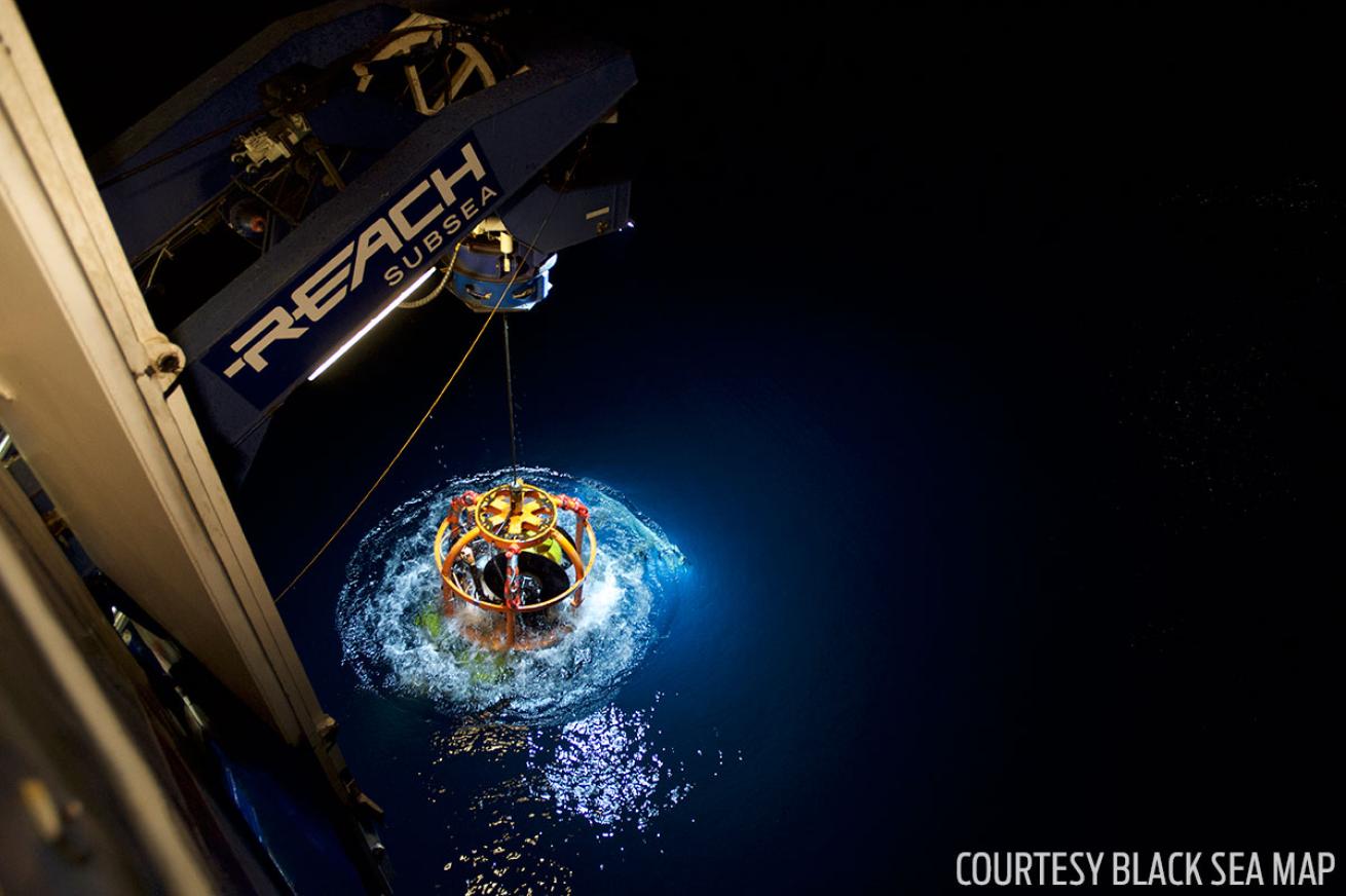
Courtesy Black Sea MAPStril Explorer - the project's research vessel for 2016, launching the Work Class Supporter ROV.
The second ROV is known as the Surveyor Interceptor and flies through the water at four times the speed of conventional underwater drones. It carries a complete host of tools for geophysical analysis including lights, a high definition camera and a laser. Since the project began, Surveyor Interceptor has set new records for depth (5,900 feet) and sustained speed (six knots or seven miles an hour) and has surveyed around 776 miles according to DailyMail.
“We’re endeavoring to answer some hotly debated questions about when the water level rose, how rapidly it did so and what effects it had on human populations living along this coast of the Black Sea,” said Adams. “The wrecks are a complete bonus, but a fascinating discovery, found during our extensive geophysical surveys.”
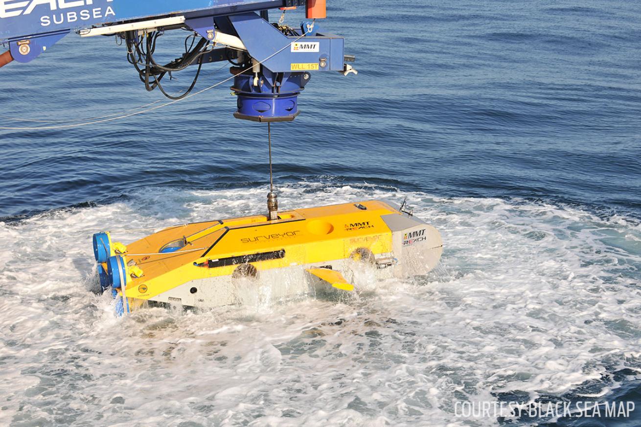
Courtesy Black Sea MAPThe Remote Controlled Vechicle (ROV) Surveyor Interceptor was Black Sea MAP’s principal survey tool in 2016 and operated at depths down to 1800m (over a mile down).
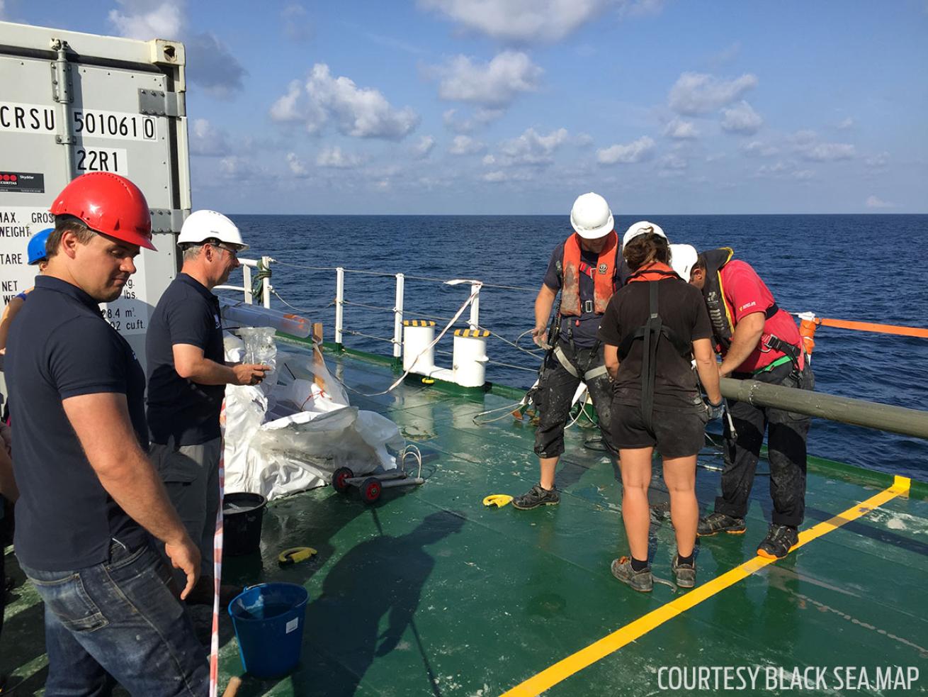
Courtesy Black Sea MAPFrom left: Dr Thomas Dhoop (CMA), Dr Justin Dix (OES and CMA), waiting to receive a 6m (20 ft) vibrocore from the Black Sea. One of 73 cores totaling 300m (984 ft) taken in a ten-day period.
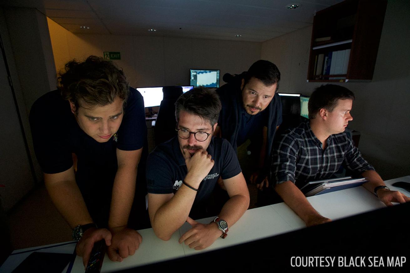
Courtesy Black Sea MAPThe team of maritime archaeologists on board Stril Explorer during the survey programme in the Bulgarian Black Sea. From left to right Felix Pedrotti, Dr Rodrigo Pacheco-Ruiz, Dr Dragomir Garbov and Dr Thomas Dhoop