
Diving for Sunken WWII Relics in Hawaii
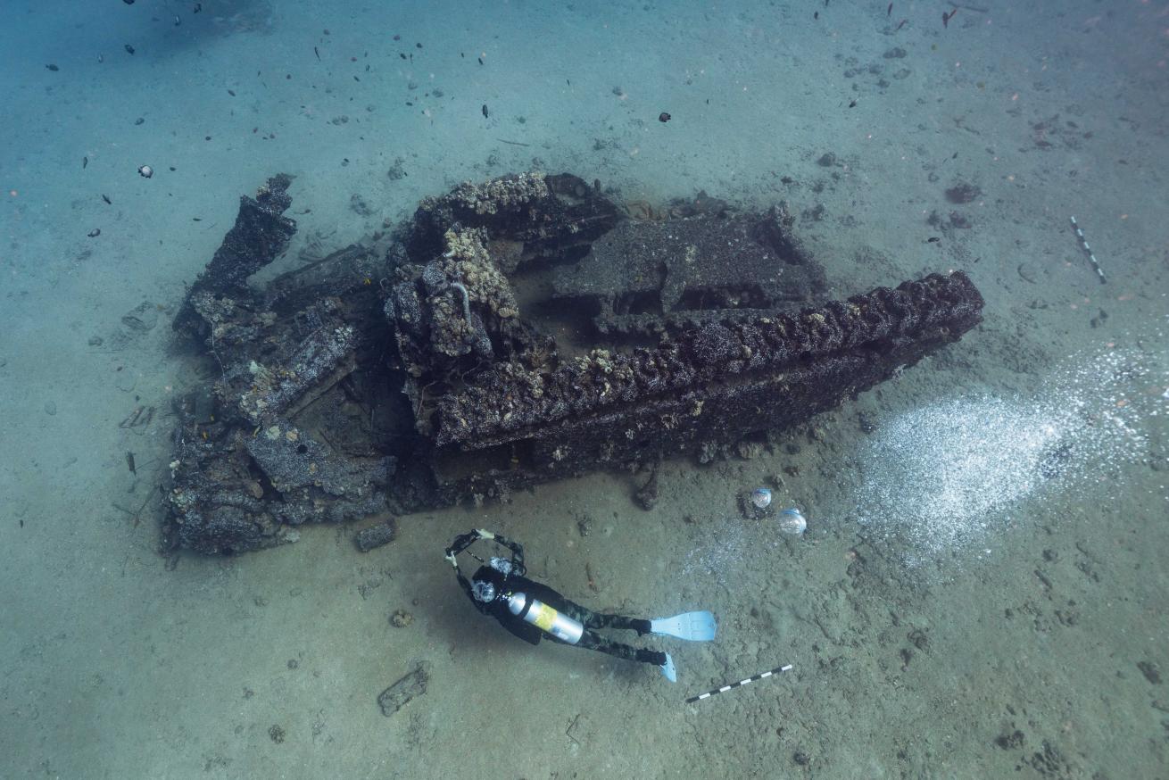
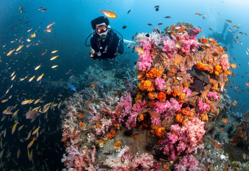
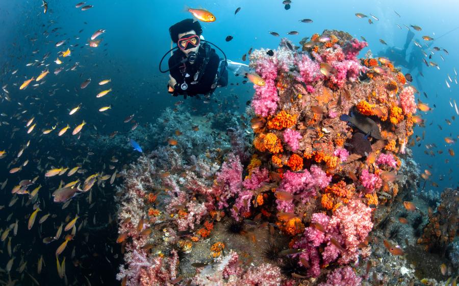
Jennifer AdlerDominic Bush creates a photogrammetric model of an amtrac (amphibious vehicle) off Maui, Hawaii.
As we descend, my eyes strain to make out darker patches on the sandy bottom. Every time I think I see something, it’s just a bed of seagrass or a shadow from overhead clouds. But once we find the plane, it’s unmistakable—the perfect outline of a small, WWII–era Helldiver. My heart skips a beat.
“This Helldiver is the most intact World War II plane I’ve ever seen,” says longtime maritime archaeologist Jason Raupp. “You rarely see them intact outside of really specific aviation museums. They’re monuments to the past that exist on the seabed.”
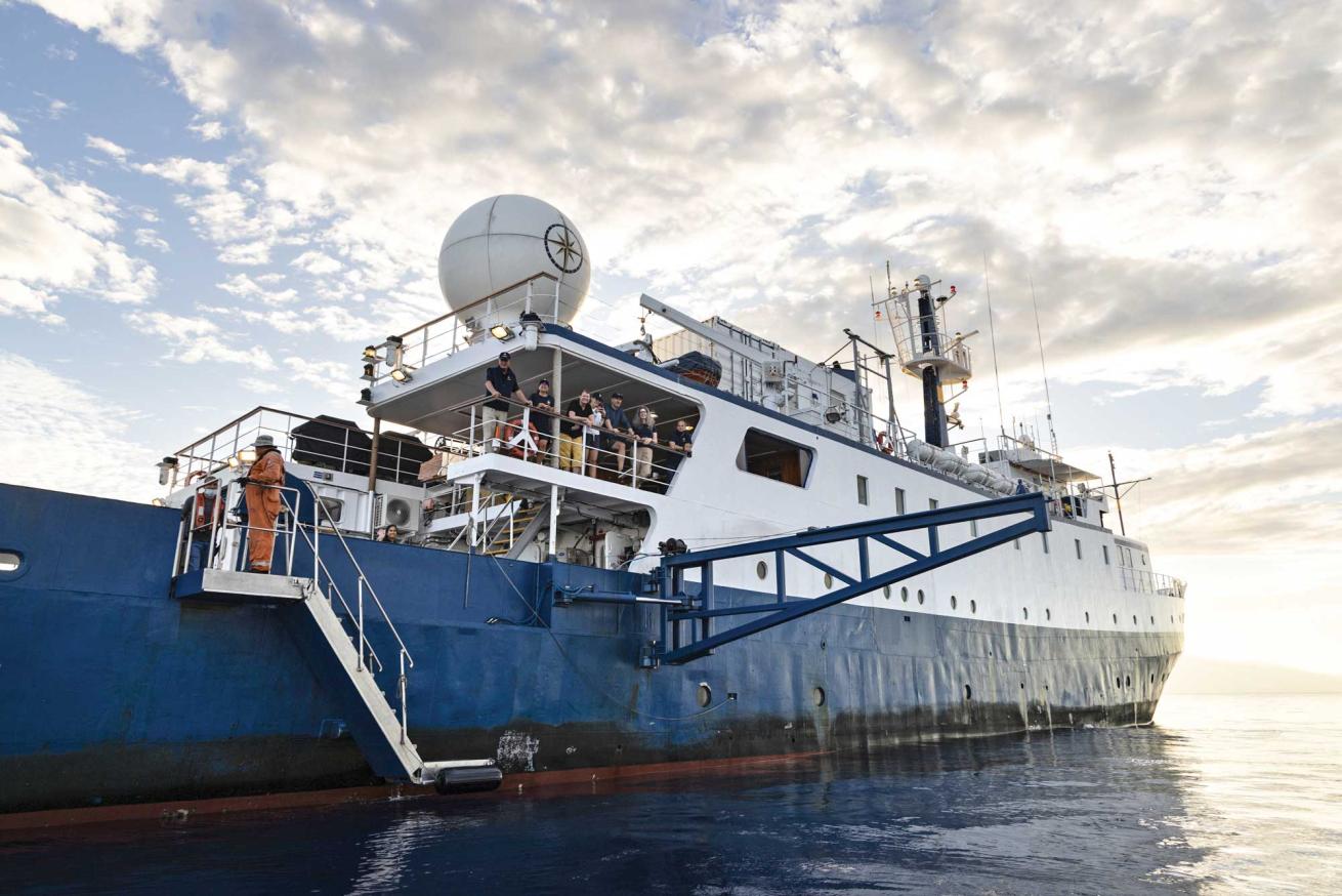
My job aboard the 13-day expedition on Bob Ballard’s E/V Nautilus is to document the exploration of sunken WWII-era planes, ships and amphibious vehicles as we sail from Honolulu to the waters surrounding Maui and Lanai. Most of the wrecks have been previously documented, but archaeologists survey sites over time to see how they change due to waves, currents, earthquakes and human disturbances.
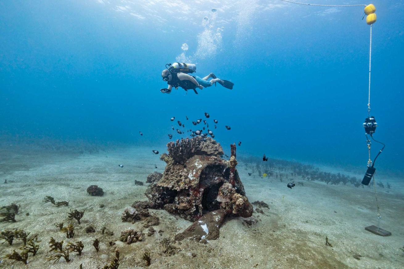
On this expedition, funded by National Geographic, four people will map nine wrecks using high-resolution 3D photogrammetry. The process takes photos from many angles and stitches them together into a 3D model of the wreck.

Jennifer AdlerClockwise from top: E/V Nautilus’ tender “Ruby” gets launched for daily operations; a curious day octopus observes the author; scientists on the expedition test a small ROV in a tub on the ship.
“When you think of Hawaii and World War II, everyone knows about Pearl Harbor,” says Dominic Bush, a maritime archaeologist from Oahu. “But what’s often forgotten is that Hawaii was this central nervous system of the war’s Pacific operations.”
Bush, now a doctoral candidate in maritime archaeology at East Carolina University, grew up in Oahu, thinking of Maui as a vacation destination. “It has hotels, resorts, nice beaches, golf courses, and all of that, but those are covering up the full extent of the history of this area,” he says. Bush tells me that Maui was the largest single training area for aviation in the United States during WWII, hosting over 100,000 service members. Large plantations and private lands were seized from locals by the military for training exercises and to construct naval air stations.
“They really transformed Maui into this simulated theater of war,” says Bush.
The Ocean Exploration Trust (OET), which owns and operates Nautilus, is most well-known for its deep-sea operations, like searching for Amelia Earhart’s plane and exploring 13,000-foot-deep ecosystems and communities surrounding hydrothermal vents. But our expedition is in shallow water, the first not involving remotely operated vehicles (ROVs).

Jennifer AdlerUSS YOG-42 sits on the reef off Shipwreck Beach, Lanai.
Searching for Shipwrecks
Some of the most bizarre-looking wrecks were assault vehicles called “amtracs,” or “amphibious tractors,” which transported troops from the sea onto the shore. This reduced casualties that resulted from dropping soldiers on the beach and making them cross on foot under enemy fire.
Every morning, we pack a lunch and gear up to spend most of the day underwater. To start the process, one of the archaeologists swims in a checkerboard pattern back and forth a few feet above the wreck while recording video on a GoPro facing down toward the seafloor. Next, they swim ascending circles to capture the site from each side—“think of it like a layer cake,” says Bush. They need overlapping video of every inch of the wreck.
Back in the data lab, Bush extracts stills in Photoshop, color-corrects them and imports them into Agisoft Metashape. This program aligns the photos and stitches them into a 3D model. The whole process takes a little under 24 hours to complete.
Sounds simple enough for the remaining wrecks in Hawaii, right? It would be… if we could find them. Hans Van Tilburg, the maritime heritage coordinator for the NOAA Office of National Marine Sanctuaries, has worked in Hawaii since 1994. He found that “from 1944 to 1945, there were about 540 aircraft lost [in Hawaiian waters],” an average of one to two a day, “which is an astounding measure of the hazardous nature of naval aviation and the importance of naval aviation in the Hawaiian Islands during the war.”
Many of these crash sites are also war graves.
“When we talk about war, it can be this distant thing and it’s oftentimes glorified,” says Justin Dunnavant, lead scientist on the expedition and an assistant professor at UCLA. Talking about and experiencing these maritime heritage sites “can help really humanize this over-glorification that we often have [surrounding war],” he says.
Related Readings: 7 Best Wrecks to Dive in Oahu, Hawaii
Life After Loss
As a marine ecologist, I started the expedition with little knowledge about the history of these submerged cultural sites, but I immediately noticed the new life they harbor. Once involved in war, these relics are now artificial reefs. Many lie in sand surrounded by Halimeda algae, fish, urchins, nudibranchs, mollusks, sea stars and octopuses.
On one of the amtracs, a day octopus (Octopus cyanea) greets us, mesmerizing me with its flashing red and white patterns and changing textures, and showing me what was once built for death and destruction now serves as a new home for ocean life. But these wrecks also have an interesting future, perhaps for divers.
Jennifer AdlerNautilus at sea.
“I would love to see some of these sites have buoys put on them so that more people could dive them,” says Raupp. “Provided you do the outreach, and you have ethical dive operators, these are sites that should be shared with the diving community.”
Van Tilburg suggests partnering with the Hawaiian Islands Recreational Scuba Association (HIRSA) to develop materials that tell the stories of these sites, including some signage onshore. Bush wants to install plaques underwater, which he says could “provoke a bit more reverence or a little bit more respect for the sites.” These efforts could contribute to a more organized wreck diving trail like those in the Florida Keys National Marine Sanctuary and the Baltic Sea.
“I think this kind of work is meant to benefit the public and not meant to be kept within academic reports or technical writings,” says Bush. “These sites are out there, and you can access them. You don’t need a Ph.D.; you don’t need to be a scientist; you don’t need to be with National Geographic.”
Bringing It Home
Back home in California, I reflected on our expedition and the impact of the 3D models. Photogrammetric models are helpful for archaeologists and researchers who can’t access the ocean or travel to Hawaii, but they’re also a great tool in the classroom. Nautilus is specially equipped to share research live from the field with schools around the world.
Jennifer AdlerJason Raupp maps a World War II–era Grumman F6F Hellcat.
“The opportunity to bring research in real-time to my students was invaluable,” says educator Ashleigh Glickley, who was up at all hours giving remote classroom presentations to her students in Kentucky. “This experience allowed them to learn more about the science as it was happening, rather than months or years later.” She even learned to dive before the trip to better share the experience with her class.
During the trip, we reached more than 8,000 students in five countries through Nautilus’ established Ship-toShore program.
“The Ship-to-Shores were definitely one of the highlights of this project,” says Bush. “I was excited to be able to talk to several classes in Hawaii, including the school that I went to from preschool to eighth grade. It made me reflect on where I’ve come from. I was excited to introduce the idea that STEM and history are viable career paths. Just because you’re out on an island in the middle of the Pacific Ocean doesn’t mean you can’t get interested in these kinds of things.”
I was not ready to go home after this trip, but the project is far from over.
Related Readings: Finding Hope for Florida’s Bleached Corals

Jennifer AdlerClockwise from top left: Dunnavant tests a small ROV; Bush maps the USS YOG-42; A complete 3D rendering of a Helldiver.
“I think this kind of work is meant to benefit the public and not meant to be kept within academic reports or technical writings.”
Now it’s about how we protect these maritime heritage sites moving forward.
“These are nonrenewable resources,” says Raupp. “There are no more Helldivers flying in the sky that are just going to happen to end up on the bottom of the ocean. So, we should all really take that in as a scuba diving community.”
These sites are our shared history and now a home for many reef fishes, octopuses, corals, crustaceans and more. Interacting with the sites through photogrammetry will help inspire future scientists.
In Glickley’s classroom in Louisville, she asks her students to consider the guiding question: “If we live in the present, why do we care about the past?” They’re connecting what they learned about our work in Hawaii to the study of ancient coral fossils at a nearby state park, the Falls of the Ohio, and learning about Kentucky’s submerged history 390 million years ago.
“This experience allowed us to break down the walls of our classroom and explore the world,” says Glickley. “It provided a space for students to identify the need for conservation of natural and historic places. Months later, students continue to approach me with ideas or reflections on the experience, which is honestly any teacher’s ultimate wish.”